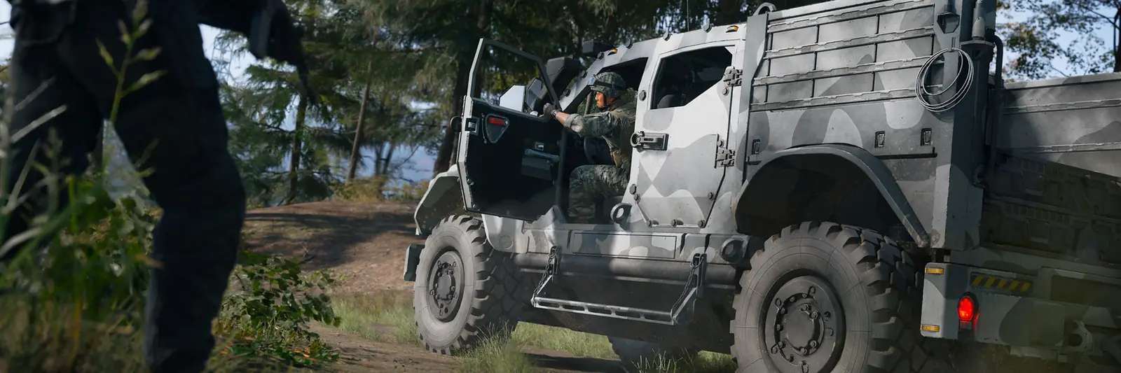
Hajin map locations
Hajin Map Locations: All 13 POIs
The 13 major points of interest in MW4 DMZ, with the threat level of each of their 35 named areas. Filter them by danger to plan your next drop.
Last updated Game version: Pre-launch (official intel, October 2026)
Activision's Hajin deep dive names 13 major points of interest and says the Exclusion Zone has more than 60 named locations in all. Three of the 13 sit on the former North Korean side in the west (14th Political Prison, Chang-san Air Base, Deadtown); 4 are districts of Hajin City in the east. Every area has its own threat level, from Low to Extreme, and it rises as you fight there. To see where they sit next to each other, open the interactive Hajin map.
13 of 13 locations
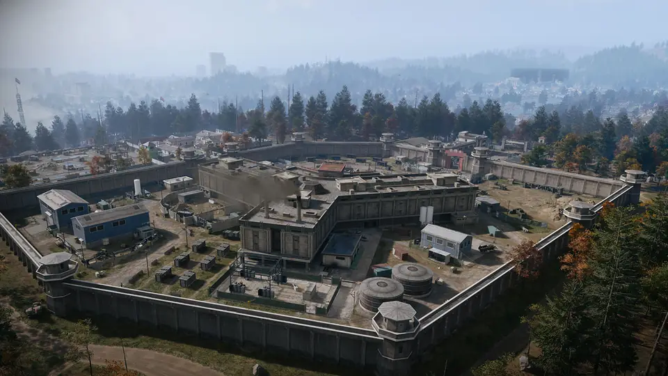
Screenshot: Call of Duty: Modern Warfare 4 © Activision (enhanced) 1. 14th Political Prison
CriticalNorthwest Hajin · former North Korean side
A walled prison on a cleared plateau in the North Korean woods, with watchtowers on every corner and a Y-shaped fortress called the Citadel in the yard.
Threat by area
Prison High The Fortress Prison Yard High The Citadel Critical What to expect
- Main entrance and checkpoint on the south side; barracks to the east
- A polluted river runs along the west side
- Construction work on the eastern side of the base
- The Citadel inside is a maze of walkways, cell blocks and a large furnace
14th Political Prison location guide: map close-up, nearby markers and neighbors
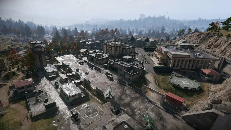
Screenshot: Call of Duty: Modern Warfare 4 © Activision (enhanced) 2. Chang-san Air Base
ExtremeWestern Hajin · former North Korean side
A heavily guarded North Korean air base built into a granite hillside, with an underground bunker complex that is larger than the base on the surface.
Threat by area
Air Base Exterior Critical Air Base Bunker Extreme What to expect
- Runway, helipad, hospital, barracks, supply depots and a command building
- Large bunker doors in the hillside to the south lead underground
- Cliffs on the east side; the blog says recon teams got in from the woods to the south
- Hidden missile bunkers and a toxic containment pool nearby
Chang-san Air Base location guide: map close-up, nearby markers and neighbors
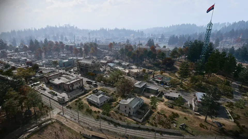
Screenshot: Call of Duty: Modern Warfare 4 © Activision (enhanced) 3. Deadtown
MediumSouthwest Hajin · former North Korean side
An emptied North Korean farm town taken over by the military, with two Re-Education Centers at its heart and a sewer system under the streets.
Threat by area
Deadtown Exterior Low Re-Education Center Medium What to expect
- Lightly armored enemies and possible convoys; street-to-street fighting
- A Clinic and a Gas Station at each end of town
- Newer blocks on the raised east side by the Hajin River hide military storage
- Follow the railroad northeast to reach small river hamlets
Deadtown location guide: map close-up, nearby markers and neighbors
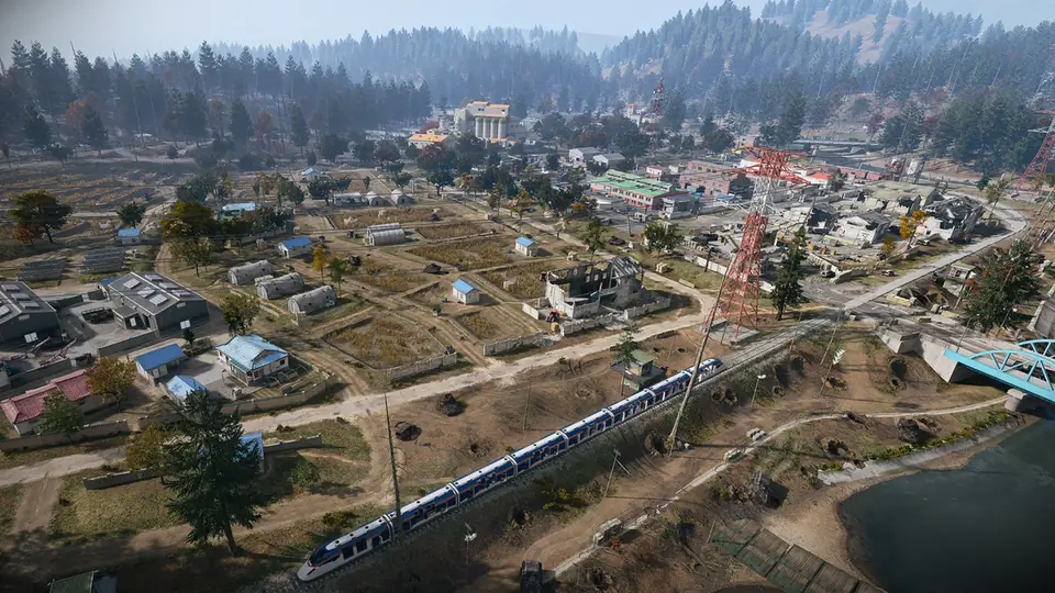
Screenshot: Call of Duty: Modern Warfare 4 © Activision (enhanced) 4. Imjin Farmland
MediumSouth-Southwest Hajin · former South Korean side
Flat rice fields and waterways on the southwestern edge between North and South, with a large Rice Mill as the high ground.
Threat by area
Farmland Exterior Low Jeong Loading Dock Low Rice Mill Medium What to expect
- Long sightlines and little cover in the open fields
- The Rice Mill gives a raised view over the farmland
- Rail lines and narrow roads meet around the mill
- Grid square D7 on the Tac-Map, per the official example
Imjin Farmland location guide: map close-up, nearby markers and neighbors
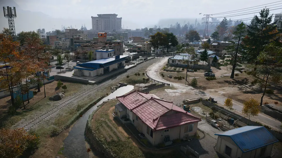
Screenshot: Call of Duty: Modern Warfare 4 © Activision (enhanced) 5. Cheongun Village
HighNorthern Hajin · former South Korean side
The most northerly South Korean area on the current map: a border village on the Hajin River, dominated by the multi-floor Heavenly Luck Casino.
Threat by area
Cheongun Village Low Russian Border Crossing Low Cheongun Outskirts Low Heavenly Luck Casino High Russian Border Low What to expect
- Border control posts to and from Russia on the west and east sides
- The Russian Border across the river is closed off and filled with fog for now
- Expressway No. 1, the main road across Hajin, runs along its south edge
- The casino has no mains power on several floors; the blog suggests NVGs
Cheongun Village location guide: map close-up, nearby markers and neighbors
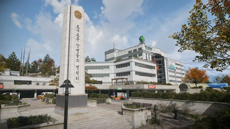
Screenshot: Call of Duty: Modern Warfare 4 © Activision (enhanced) 6. Mirae General Hospital
LowNorth Central Hajin · former South Korean side
Hajin's main hospital, roughly in the middle of the map, next to a train station and west of The Grid and NuriGO Mall.
Threat by area
Mirae General Hospital Low What to expect
- Triage tents and temporary barracks around the stepped grounds
- Close-quarters fighting through color-coded wards and stairwells
- Expressway No. 1 runs along the north side
- Mujin Pass lies to the south, Cheongun Outskirts to the west
Mirae General Hospital location guide: map close-up, nearby markers and neighbors
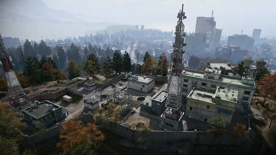
Screenshot: Call of Duty: Modern Warfare 4 © Activision (enhanced) 7. Cheonwang Peak Array
MediumCentral Hajin · former South Korean side
The largest telecom array in Hajin, on a flat summit in the South Korean wilderness, now held by enemy forces.
Threat by area
Cheonwang Peak Array Medium What to expect
- The DBN TV station grounds have been turned into barracks
- A helipad on the roof with long views over the area
- Boulder trails to the west and Daesong Ridge nearby
- Woods to the north lead down to Mujin Pass and the Hospital
Cheonwang Peak Array location guide: map close-up, nearby markers and neighbors
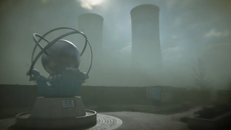
Screenshot: Call of Duty: Modern Warfare 4 © Activision (enhanced) 8. Haneul Nuclear Reactor
HighNortheast Hajin · former South Korean side
A damaged reactor site under a cloud of radioactive vapor. Protective gear and a gas mask are needed to survive there.
Threat by area
Reactor (with radiation) High South Korean Border Zone Medium What to expect
- Radiation is strongest inside the reactor building
- The blog says a breach covers the containment block and Reactor 02; Reactor 01 is still stable
- Possible ways in: by water, or through a tunnel from Compound Delta to the southwest
- Fire Stations are where the blog says to look for Radiation Gear
Haneul Nuclear Reactor location guide: map close-up, nearby markers and neighbors
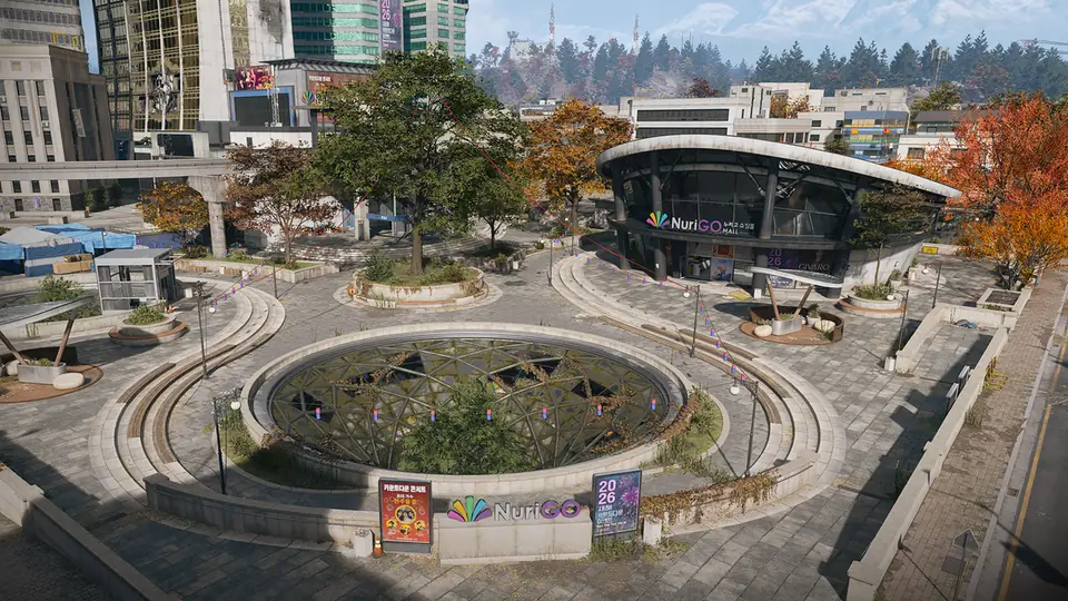
Screenshot: Call of Duty: Modern Warfare 4 © Activision (enhanced) 9. NuriGO Mall
HighNortheast Hajin City · former South Korean side
A shopping district north of the Hajin City skyscrapers, with a large underground mall below a courtyard of circular structures.
Threat by area
NuriGO East Medium NuriGO West High What to expect
- Police station, clinic, City Hall and a monorail station on the surface
- The underground mall has no power; the blog suggests NVGs
- Tenement blocks on the west edge, near the Hospital
- The Grid, a fortified zone, lies to the south
NuriGO Mall location guide: map close-up, nearby markers and neighbors
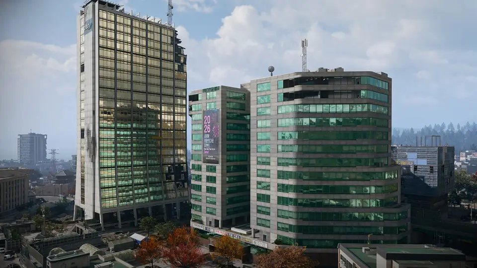
Screenshot: Call of Duty: Modern Warfare 4 © Activision (enhanced) 10. The Grid
ExtremeCentral Hajin City · former South Korean side
The walled-off business district at the center of Hajin City, the most heavily defended part of the city, with fighting on rooftops and in the streets.
Threat by area
The Grid Critical Nenshin Tech Complex Extreme DBN Headquarters Critical Hanex Bank Critical Minsok Art School Critical Construction Zone Critical What to expect
- Barricaded roads, razor wire, watchtowers and roving patrols
- The DBN TV tower, the tallest building in Hajin
- A red-roofed twin high-rise tech complex with the highest threat level
- Few escape routes at street level
- The blog spells the tech complex two ways, Nenshin and Netshin; we use the spelling in its threat list
The Grid location guide: map close-up, nearby markers and neighbors
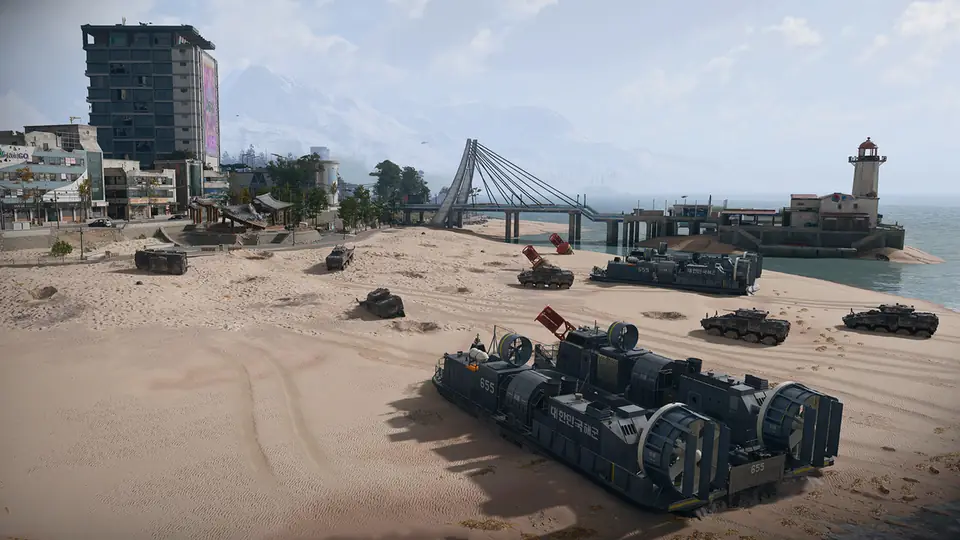
Screenshot: Call of Duty: Modern Warfare 4 © Activision (enhanced) 11. Songdo Wharf
LowEastern Hajin City · former South Korean side
A quieter seaside district on the east coast, between the nuclear plant to the north and the south fork of the Hajin River.
Threat by area
Songdo Wharf Low Oamsik Turtle Island Low Shoreline Station Low What to expect
- Train and monorail services still run here
- A market, a pier with a lighthouse and a small island to explore
- La Grande Vie, a luxury tower, in the residential north
- Signs of an amphibious landing at the southern tip
Songdo Wharf location guide: map close-up, nearby markers and neighbors
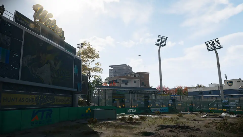
Screenshot: Call of Duty: Modern Warfare 4 © Activision (enhanced) 12. Wolves Stadium
MediumSouth Central Hajin City · former South Korean side
A ruined baseball stadium south of The Grid, with an abandoned open-air theatre to its north and mixed streets around it.
Threat by area
Wolves Stadium Medium Theatre Medium What to expect
- A Police Station and a bank building nearby
- The monorail runs southwest to a bridge and a ruined park
- The northern edge, next to The Grid, is the most dangerous part
- A partly destroyed apartment block in the northeast corner
Wolves Stadium location guide: map close-up, nearby markers and neighbors
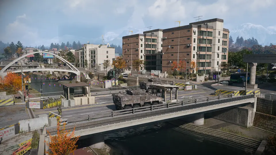
Screenshot: Call of Duty: Modern Warfare 4 © Activision (enhanced) 13. Hajin River Heights
MediumSoutheast Hajin · former South Korean side
A heavily damaged residential area south of Wolves Stadium, bounded by the south fork of the Hajin River.
Threat by area
Hajin River Heights Medium South Island Medium Jinseo Park Towers Medium What to expect
- One apartment building is now a military base called Compound Echo
- Jinseo Park Towers near a ceremonial park further south
- A lone comms tower on South Island
- Wooded hills of the South Korean wilderness beyond
Hajin River Heights location guide: map close-up, nearby markers and neighbors
Quick table: every Hajin POI by highest threat
| Location | Where | Highest threat |
|---|---|---|
| 14th Political Prison | Northwest Hajin | Critical |
| Chang-san Air Base | Western Hajin | Extreme |
| Deadtown | Southwest Hajin | Medium |
| Imjin Farmland | South-Southwest Hajin | Medium |
| Cheongun Village | Northern Hajin | High |
| Mirae General Hospital | North Central Hajin | Low |
| Cheonwang Peak Array | Central Hajin | Medium |
| Haneul Nuclear Reactor | Northeast Hajin | High |
| NuriGO Mall | Northeast Hajin City | High |
| The Grid | Central Hajin City | Extreme |
| Songdo Wharf | Eastern Hajin City | Low |
| Wolves Stadium | South Central Hajin City | Medium |
| Hajin River Heights | Southeast Hajin | Medium |
What is around each location: the official Tac Map
Activision's interactive Hajin Tac Map, online since October 19, marks smaller named areas and places such as UAV Towers and Ammo Armor Caches. Here each one is listed under the major location it is closest to on the map (our grouping, by distance). The interactive Hajin map shows them all and lets you switch each kind on or off.
| Location | Named areas nearby | Also marked nearby |
|---|---|---|
| 14th Political Prison | Tong-il Village | Fortress: The Citadel; 1 Lieutenant Tower; 1 UAV Tower; 1 Ammo Armor Cache; 1 Police Station; 2 Clinics; 2 Gas Stations |
| Chang-san Air Base | Pyonghwa Village | Fortress: Admin Complex No. 2; 1 Compound; 1 UAV Tower; 3 Ammo Armor Caches; 1 Police Station; 1 Fire Station; 1 Clinic; 1 Gas Station |
| Deadtown | — | Fortress: Re-Education Center; 1 Lieutenant Tower; 1 UAV Tower; 1 Ammo Armor Cache; 1 Fire Station; 2 Gas Stations |
| Imjin Farmland | Namjin Riverside | Fortress: Rice Mill; 1 Compound; 2 UAV Towers; 4 Ammo Armor Caches; 1 Fire Station; 2 Gas Stations |
| Cheongun Village | Russian Border Crossing, Cheongun Outskirts | Fortress: Heavenly Luck Casino; 2 UAV Towers; 4 Ammo Armor Caches; 1 Police Station; 1 Fire Station; 1 Clinic; 2 Gas Stations; 1 Marine Gas Station |
| Mirae General Hospital | — | Fortress: Mirae General Hospital; 1 Compound; 1 UAV Tower; 2 Ammo Armor Caches |
| Cheonwang Peak Array | Imjin Suburb, Mujin Pass, Daesong Ridge | 1 UAV Tower; 1 Ammo Armor Cache; 2 Clinics; 3 Gas Stations |
| Haneul Nuclear Reactor | Russian Border Crossing (East) | 1 Lieutenant Tower; 1 UAV Tower; 3 Ammo Armor Caches; 1 Marine Gas Station |
| NuriGO Mall | NuriGO West, NuriGO East | Fortress: NuriGO Mall; 1 Compound; 1 UAV Tower; 2 Ammo Armor Caches; 1 Police Station; 1 Fire Station; 2 Gas Stations |
| The Grid | DBN Headquarters, Hanex Bank | 1 Ammo Armor Cache; 1 Gas Station |
| Songdo Wharf | Oamsik Turtle Islands, Shoreline Station, Construction Zone, Songdo Pier | 1 UAV Tower; 2 Ammo Armor Caches; 2 Gas Stations; 1 Marine Gas Station |
| Wolves Stadium | — | 1 Compound; 1 Lieutenant Tower; 3 Ammo Armor Caches; 1 Clinic; 1 Gas Station |
| Hajin River Heights | South Island | 1 Compound; 1 Lieutenant Tower; 2 UAV Towers; 1 Ammo Armor Cache; 1 Police Station; 1 Marine Gas Station |
Minor points of interest
Activision has also given a first look at some smaller places. More will turn up once players are in Hajin.
- Hajin River: The river starts in the western mountains and flows east and south to the sea near the Reactor and Songdo Wharf.
- Tong-il Village: A farming village on the north delta of the Hajin River, with a large statue of a past leader.
- Revolution Dam: An intact dam with a strong military police presence; Tong-il Village is just to the southeast.
- Pyonghwa Village: Houses and farmland west of the Hajin River, with a partly destroyed pontoon bridge for vehicles.
- Imjin Suburb: A small farm workers' hamlet on the Hajin River, at the foot of a wooded hill near the railroad.
- Mujin Pass: A farming community on a main road between two forests, with the Hospital to the north and the Array to the south.
- Daesong Ridge: A rural settlement with burned-out APCs along the road, just northeast of Imjin Farmland.
- Namjin Riverside: The southern edge of Hajin, with abandoned civilian cars near a tunnel exit by the south fork of the river.
Places marked on the Tac-Map
Besides the named locations, these kinds of places show up across Hajin and are marked on your Tac-Map. Each one makes some loot more likely. A useful tip from the blog: building colors give them away, with red Fire Stations, blue Police Stations and green Clinics.
- Gas Stations: Repair and refuel ground and air vehicles, and refill Gas Cans.
- Marine Gas Stations: A small jetty with two pumps for repairing and refueling boats; Gas Cans can be refilled too.
- Fire Stations: Red buildings, usually in built-up areas. Look here for Radiation Gear and Parachutes. Expect enemies.
- Police Stations: Blue buildings with many rooms and sometimes roof access. Look here for military gear and a locked Armory.
- Clinics: Green buildings that may hold medical loot. Players sometimes wait inside to ambush.
- Exfils: Picked from a pool of sites and marked with green smoke. Call the helicopter and hold until it lands. Other squads may wait there.
- Ammo & Armor Caches: Refill ammo and Armor Plates, often inside enemy compounds. Each cache has a cooldown after use.
- UAV Towers: Activate one for a Side Op, DMZ Cash and a pulse that shows nearby players and enemies.
- Compounds: Fortified enemy positions with better loot and intel. Going in quietly is often easier.
- Bounty Stations: A laptop where you can check bounties on players or pay off your own bounty with DMZ Cash.
- SAM Sites: Hack the control computer and hold it; the battery then shoots at enemy aircraft while you stay nearby.
- Lieutenant Hunts: Climb the tall comms tower and use the laptop at the top to get intel on a nearby Lieutenant.
Exfils and caches are where fights happen. Our beginner's guide to DMZ explains how exfil works, and the threat levels guide covers the enemies guarding compounds and the Commanders that roam between places. Driving or flying? The MW4 DMZ vehicles guide lists every vehicle Activision has named and what each Paid Infil costs.
Keys and locked rooms
Keys open special loot rooms, and each key's description names a grid square on the Tac-Map. Lieutenants can drop a key to their own loot room. Our DMZ key finder lists each confirmed key with its place, its grid square and the door it opens.
Sources
- DMZ Deep Dive, Part 1: Tour of Duty – Hajin Environments and Threats, Full Intel Guide (October 5, 2026)
- Call of Duty Guides: Hajin Tac Map (DMZ) (October 19, 2026)
Checked against the official posts on October 19, 2026. Before launch, everything here is Activision's own description; we update the page once the game is out and details can be confirmed in play.
Continue reading
 Next stepPicked a place to drop? See what each threat level sends after you.DMZ Threat Levels, Enemies and BossesThe five threat levels, every enemy type named so far, the Lieutenants and Commanders on the Boss Board, and which places start at Extreme.Go there
Related guides
- Getting startedDMZ Beginner's Guide: FOB and First RunsHow a DMZ deployment works from infil to exfil, which FOB stations open at which level, and what happens when you die.
- FAQMW4 DMZ FAQ: Free, Solo, PlatformsStraight answers on price, solo play, platforms, early access, map size and what you keep after a failed exfil.
- ProgressionDMZ Operator Prestige RequirementsThe gear and DMZ Cash each Operator Prestige takes, what you get for it, and a checklist to track what you still need.
Card pictures: Screenshot: Call of Duty: Modern Warfare 4 © Activision (enhanced)